

Since my wife has become more successful in her new career as a romance author, we have had the opportunity to move the Signal Mountain Tennessee. More specifically, we live on Walden’s Ridge directly astride Grant’s route into Chattanooga in the fall of 1863. Though we formally bought our house in the fall of 2017, I had to finish out the academic year at the university where I worked in Texas. Since I was towing my fifth wheel travel trailer with me, I decided to stop at Vicksburg, MS and Shiloh, TN on my way to Tennessee. Following my road trip, I began examining the Civil War sites closest to my new home, Lookout Mountain, Missionary Ridge, and Brown’s Ferry. In this installment I will share with you some of the more interesting things I came across during this summer of Civil War Reflection. As I continue to explore around my new home and settle in with my new Re-enactment unit, Co. E 8th Tennessee (Union), I will post more in depth blogs.
Before I began my trip, I really tried to do some research on the sites I would be visiting. I must confess, that as a fan of U.S. Grant and James Longstreet, I never got around to researching the Battle of Chattanooga much. A lot of attention is placed on what I call the big five events of the Civil War, Antietam, Gettysburg, Vicksburg, Sherman’s March, and Petersburg/Appomattox but had Chattanooga been a Confederate Victory it is entirely possible that the war would have lasted two to three more years. As for Vicksburg and Shiloh, I have paid a lot more attention to these conflicts in my research. Both fascinate me for the way they demonstrate the evolution of what I believe were two underrated commanders, namely U.S. Grant and William T. Sherman.
VICKSBURG MS.
I departed Tolar, Texas for Vicksburg, Mississippi at 04:00hrs on May 19, 2018. The trip to Vicksburg took a little over six hours and I was able to disconnect my trailer and proceed to the battlefield in the early afternoon. A couple of things the reader should understand before I post any pictures of the battlefield. In 1863, Vicksburg was sparsely vegetated due in part to the clearing of fields of fire around the bluffs, military and civilian excavations, and artillery bombardments. Today, you cannot see the no man’s land between the lines except at a couple of spots due to overgrowth of conifers, oak trees, and an invasive species of ivy which makes the battlefield look like a jungle. In late 1862, Maj Gen. Grant had been restored to field command after Maj Gen. Henry W. Halleck had been moved to Washington to assume command as General in Chief of all Union Armies (Catton, 2000).
Before settling into a siege in May of 1863, Grant had experimented unsuccessfully with several ventures to take Vicksburg. Vicksburg was strategically located on high bluffs which overlooked the Yazoo and Mississippi River at one of the bends in the Mississippi. Although fortified, during and inspection tour, Confederate General Joseph E. Johnston was not pleased with the fortifications. According to Foote (1986), “To his professional eye, they not only left much to be desired in the way of execution; their very conception it seemed to him was badly flawed” (p. 10). After almost two months of protracted siege warfare Vicksburg’s commander, a Confederate officer from Pennsylvania, Major General John C. Pemberton surrendered his forces to Grant on July 4, 1863 the same day Lee withdrew from Gettysburg (Hathaway & Jones, 1991).
Rather than tying up transport ships, Grant elected to parole the Confederate prisoners in Vicksburg. Ostensibly, prisoners of war on parole were required to be kept in their respective side’s camps and could not engage in armed hostilities until exchanged for a prisoner of the other side. Paroles freed capturing armies of the burden of feeding and caring for prisoners while depriving the opposing side of armed troops. In the 19th Century belligerents generally honored paroles because the consequences if being capture in combat without being properly exchanged could include execution (Stoker, 2010).
As I drove through the somewhat claustrophobic entrance to the National Park, I was struck by the number of monuments. I often hear re-enactors complain of monument pollution. At Vicksburg the monuments are necessary in order to geographically mark positions, otherwise you’re just driving past a continuous berm in the middle of woods. Timing of my trip was not ideal. Early afternoon thunderstorms and squadrons of biting insects who laugh at repellant forced me to conduct a driving tour. Despite the petty inconveniences, I was able to make the best of my trip. On the second day of the trip, I left before the heat and humidity of the day became unbearable. To anyone visiting Vicksburg there are three places that are definitely worth seeing, 1) The surrender site, 2) the Cairo wreck, and 3) the National Cemetery.


The site where Grant sat down with Pemberton to discuss the terms of surrender, is located at a lower piece of ground between the Union and Confederate lines across a paved road from the old National Park headquarters. To appreciate this site requires you to remove yourself from the current time period and place yourself on that hot July day in 1863. When you look up from either side you cannot help but realize how venerable you are out there in the open between two armies. Confederates had made a practice of rolling hog’s heads (55 gallon barrels wooden barrels) full of gunpowder down the hill at Union troops. Both sides had made sport of sniping at anyone who poked their heads above the edge of trenches. In an earlier message to Grant, Pemberton arrogantly claimed to have enough rations to hold out indefinitely. When Grant accepted his surrender and marched his troops into town the truth was revealed. The citizenry and soldiers were reduced to consuming any form of animal protein which could be found including horses (Catton, 2000).


The wreck of the USS Cairo is one of the rare examples of a shipwreck you can actually walk through. The USS Cairo was commissioned into active naval service in January of 1862. On December 12, 1862, the Cairo’s skipper Lt. Commander Thomas Q. Selfridge was in charge of a flotilla of gunboats moving down the Yazoo to neutralize Confederate batteries and remove torpedoes (underwater mines) in order to open a waterway toward Vicksburg. At point between seven and eight miles north of Vicksburg two sudden explosions opened up the Cairo and it sank without any loss of life in just under 15 minutes (Johnson, 2002). The Cairo would be the first ship in naval history to be sunk by electrically detonated mines.


In 1964 the USS Cairo was raised from its muddy grave and transported to a shipyard for storage. In 1972, Congress approved funding for relocation and restoration of the ship. Due to funding shortfalls, in 1977 the restoration stopped. The Cairo sits on high ground just northeast of the National Cemetery at Vicksburg (National Parks Service, 2018). Wooden catwalks allow visitors to walk through the once proud gunboat and look at the technological advances of the mid 19th century. The adjacent museum has hundreds of preserved artifacts including journals, medical supplies, disarmed munitions, weapons, and many other artifacts. As you walk through this vessel you have to imaging the noise, smells, claustrophobic darkness below decks. The National Parks Services has done an outstanding job of preserving and displaying both the ship and the artifacts. Some of these items look as if they were just unwrapped from their packaging while others show the effects of time and submersion.


The final spot on my visit to Vicksburg is the National Cemetery. The Parks Service has done a tremendous job of maintaining the beauty and solemnity of this final resting place for the men who fought at Vicksburg as well as other veterans who have fallen since its opening. The cemetery at Vicksburg is a series of concentric descending tiers with a view of the river. It’s peaceful and quiet with one exception during visit, a father letting his kid run amuck until stopped by a park ranger. Prior to World War II cemeteries (national or private) were always places regarded with quiet dignity and respect. For the last 60 + years our society has seen fit to disregard what they represent.
SHILOH, TN
Though I’ve visited Shiloh four times now, this trip which also included a trip down to the Corinth Interpretive Center was another opportunity to learn some new things. Shiloh was calamitous for both sides involved. On the first day of the battle on April 6, 1962, the Union forces almost got pushed into the Tennessee River but the Confederates lost General Alfred Sidney Johnston (the highest ranking General officer to die in the war). The next day, with the help of lackluster performance by Gen. P.T.G. Beauregard and the arrival of Union Re-enforcements the Union was ultimately successful in chasing the Confederates from the field.
Sadly, for me, part of the Military Parke (about 1/3rd) was closed due to Bald Eagle activity. There is a permanent nest of Eagles which resides Buell’s section of the battlefield and their immature hatchling was out of the nest but unable to fly a significant distance. The activity was being closely monitored by naturalist on the park’s payroll. During this trip around the park I took a lot fewer photographs and spend more time following the footsteps of the Union regiments on their first day of battle. In doing so, I tried to imaging the fear, confusion, and chaos of that first bloody day of fighting. The opening of the battle was not too far from the Methodists Meeting house which gives the battlefield its name. Just behind the actual modern Methodists church is the field where an academically acclaimed high school once stood. The school was built in the late twenties and torn down in the late 1950s. All that remains is the remnants of its foundation.
At Shiloh’s visitors center the Park Service set up a white board in preparation for Memorial Day where members could write the name of a family veteran who served their country and passed away. I put my dad’s name on the white board. I thought it was a very nice gesture on the part of the NPS. Over both days I did some exploring of the National Cemetery at Shiloh. It is breathtakingly beautiful and solemn. It is on high ground overlooking the Tennessee River and it,s quiet, incredibly quiet. Birds and squirrels move around the grave markers and headstones and really give meaning to the places namesake. Shiloh is the Hebrew expression for place of peace (Riedel, 2016).


Since I could not visit much of the Shiloh due to the park closure, I did get to go down to Corinth and visit the National Parks’ interpretive center. The Corinth Interpretive Center is a small museum situated on the east side of the town. As you walk up from the parking lot to the museum, you see that they have different bronzed artifact molded into the sidewalks to the building. Few people who study Shiloh and little else fail to realize that Corinth was the original objective of the union forces and that the Confederate Surprise attack on the 6th of April put Union plans for the capture of Corinth on hold (Daniel, 1997). Because it is an interpretive center, it is designed to tell a story and allow people to reflect on what took place.
CORINTH, MS.
Corinth was a small town in the 1860s. It was never intended to house and feed thousands of troops. For the six months of February to July 1862 it would see tens of thousands of both sides. It would be besieged and become one of the most fetid places of the war. It does not capture headlines because it was a stepping off point for the Confederates before the Battle of Shiloh and a transitional point between Halleck assuming command in the field and being recalled to Washington to assume command of all Union forces. To its credit the Interpretive Center does and outstanding job of telling that town’s story, not just from the military prospective but from the civilian perspective as well. Though 600,000 men and women died in the service of their respective sides during that war, hundreds of civilians would be trapped between both political sides of this war. Their homes were turned into hospitals, their fields into open latrines, and their lives completely turned upside down. It’s important not to lose sight of this when you study wars.
On my second day at Shiloh, I visited the Museum of the Tennessee River located in Savanah Tennessee. This museum is under renovation and has a lot of interesting displays which don’t just focus on the Civil War but also tell the story of the settlement of Tennessee, displacement of Native Americans from Tennessee, the Naval Battles during the Civil War, and the influence of the river during the 20th Century. What can I say? I’m a history geek and I can get lost in museums. The museum is quaint, the staff is friendly, and there is something for everyone in this museum.
CHATTANOOGA, TN


After finally getting settle into my new home, I did some exploring around both with my Mother-In-Law and myself. Since living here I’ve been to Lookout Mountain, Brown’s Ferry, Signal Point (the smallest Civil War park), and Missionary Ridge. Our current home sits along the path Grant followed in the Fall of 1863 to relieve the siege of Chattanooga. In fact, one of the roads which leads to the street our house is on Corral Road, was a corral location for the horses of Union forces manning a signal station (Catton, 2000). As I mentioned earlier, Chattanooga is a battle that actually shortened the war by essentially bifurcating the Confederacy.
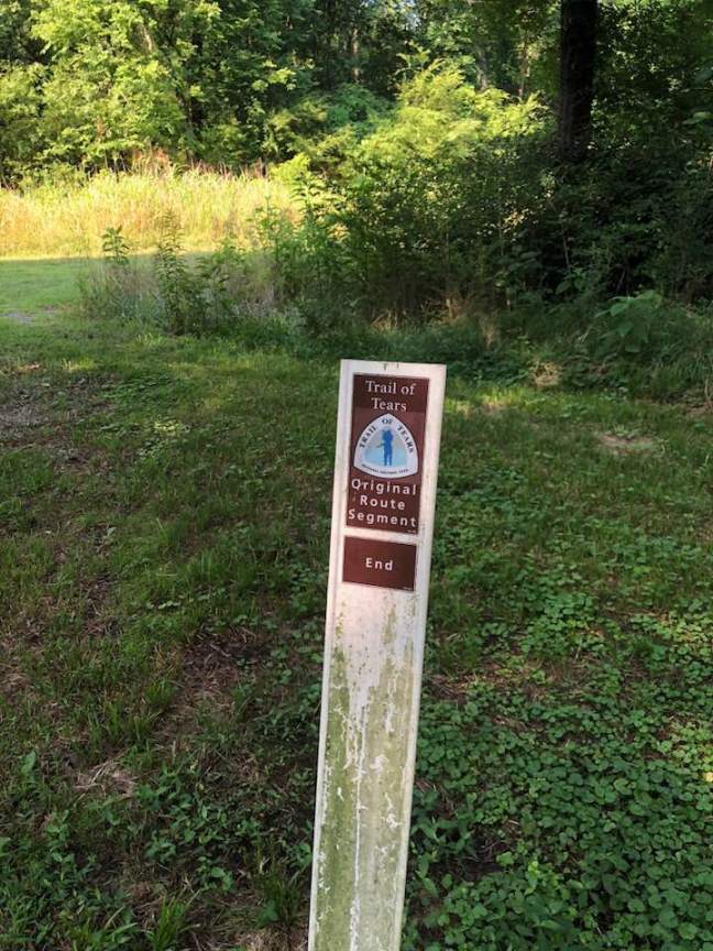
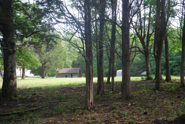
We’ll begin with Brown’s Ferry. Brown’s Ferry is notable for two key roles it played in 19th century history, the Indian Removal Act and the opening of the Cracker Line which relieved the near starvation conditions of the Union forces in Chattanooga. On the morning I set out to find Brown’s Ferry, which is only about a 15-minute drive from my house, I did not realize that I would end the trip with soaked feet from marshy and dewy conditions culminating in two small hikes. I found a trailhead which from my understanding of maps coincided with a point parallel to the actual ferry location. After dodging mosquitos, hearing animals moving in the brush, and wondering if I was going to be on an episode of one of those real crime dramas where the person mysteriously goes missing. I came across a jogger who gave me the real location of where I needed to go, so I retraced my steps back to my car and felt much better when I saw an NPS sign for Brown’s Ferry and a small parking cutaway. I followed the trail markers and was surprised to discover that the Ferry’s first historical function was a crossing point west for the Cherokee who were evicted from Tennessee during the Indian Removal Act of the 1830s. I’m sure some of our 21st century historical revisionists would claim this was Fake News and that the Cherokee were really a threat to national security (yes, this is sarcasm on my part). For the under educated, the Indian Removal Act was the beginning of the ethic cleansing of native American culture from eastern seaboard of the United States. It required that native Americans either, assimilate into white culture (as second class members of society) or relocated to lands west of the Mississippi river between the Red River and the Plate River (Brands, 2005). Ostensibly, Jackson sold this as a humanitarian solution to the inevitable conflict brought about by continued incursions into Native American lands by white settlers in areas consisting of present day Tennessee, Alabama, Georgia, and Mississippi. The reality would be a re-enforcement of a regional bias and virtual extinction of Native American culture.
Flash forward to the fall of 1863. Brown’s Ferry provided the Union forces sent to relieve Chattanooga the opportunity to secure a beachhead of sorts which would allow for the transport of desperately needed forage and supplies into Chattanooga and allow the Union to occupy, secure, and re-enforce Lookout Valley on the west side of Lookout Mountain. Sadly, today all that remains is a wide swath of cleared trees where the old corduroy road once stood and an open field protecting a chemical Plant to the southwest of the crossing site.

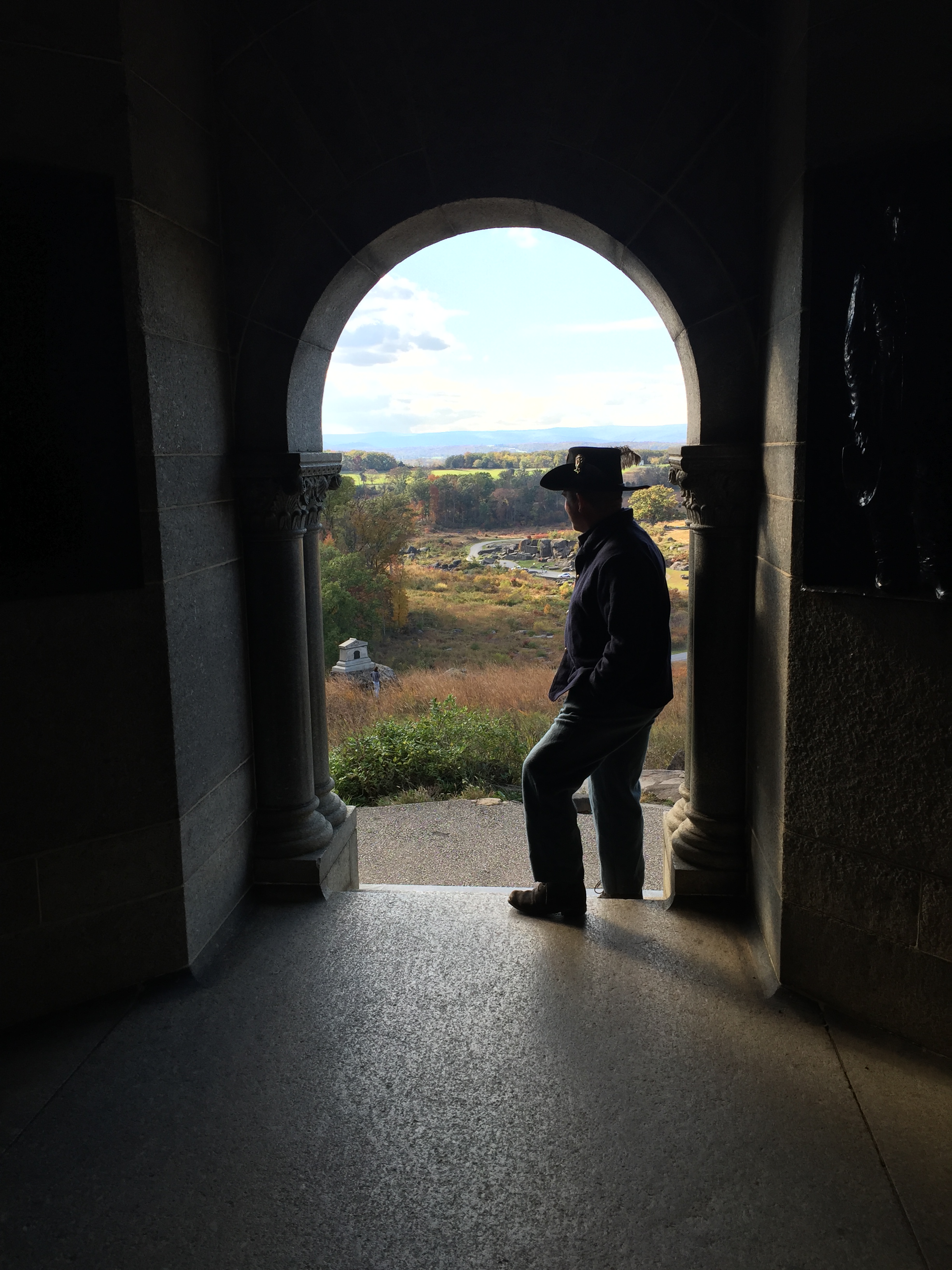
Early in June, my Mother-In-Law Jane stopped by for a visit and I took her on a tour of Lookout Mountain and Missionary Ridge. From a historian’s perspective, this tour was less than ideal, like Fredericksburg and Vicksburg, after the battle and the war, residents of Chattanooga immediately began rebuilding their lives and as the industrial importance of Chattanooga’s location became more evident, the city swallowed up most of the former battlefield to accommodate urban sprawl. The drive across Missionary Ridge offers very few opportunities to park your car and observe. It’s a 25mph road with no shoulders to speak of and very expensive houses on the crest. There is one significant pullout at De-Long Reservation-National Military Park. Don’t let the name fool you, there are only about 10 parking spaces (very narrow) and the park is only about 200’ x 100’. One of these day’s I will have to bite the bullet, pack a bag with water and snacks and walk the entire 4-5 miles of Crest Road to fully explore Missionary Ridge. Today the Chattanooga area and its surrounding hills are lush and covered with trees and vegetation. This was not the case in 1863, the landscape was barren because both armies felled trees to build works, fires, and structures. From the city with a spy glass you could clearly see artillery emplacements on both Missionary Ridge and Lookout Mountain. That is not the case today.


I’ve made a couple of trips to Lookout Mountain since moving to Tennessee. On my most recent trip there was one particular spot I wanted to see the first was Robert Craven’s house. Robert Craven managed an iron production facility in Chattanooga before the war. Appalled by the pollution his plant produced he move up on the east side of Lookout Mountain a couple hundred feet below the top on a brow overlooking the city. During the war his house became a headquarters for Confederate commanders during the Battle and by the end of the fight, all that would remain were a few shattered planks and the frame of the chimney (Cozzens, 1994). Like so many Civil War sites today, Lookout mountain is kind of sad (except for the views). There is a meager NPS museum and a civil war souvenir shop at the summit and little else. Parking on the Mountain is expensive and the park really does not do justice to either sides sacrifices during the war. I do not mean to disparage the NPS employees, they must work within their budget and geographic restrictions, but sadly for history, Lookout Mountain is and elite neighborhood of expensive home which make Civil exploration difficult.
I hope you have enjoyed this somewhat disjointed and rambling post. I will be posting more detailed stories as I explore my new environs over the next several months.
References:
Brands, H. (2005). Andrew Jackson: His life and times. New York, NY: Anchor Books.
Catton, B. (2000). Grant moves south. Edison, NJ. Little Brown & Co.
Cozzens, P. (1994). The shipwreck of their hopes: The battles for Chattanooga.
Chicago, IL: University of Illinois Press.
Daniel, L. (1997). Shiloh: The battle that changed the Civil War. New York, NY:
Simon and Schuster Books.
Foote, S. (1986). The Civil War a narrative: Fredericksburg to Meridian. New York, NY:
Vintage Books.
Hathaway, H., & Jones, A. (1991) How the north won: A military history of the Civil War.
Urbana, IL: University of Illinois Press.
Johnson, C. (2002). Bull’s-eyes and misfires: 50 people whose obscure efforts shaped the
American Civil War. Nashville, TN: Rutledge Hill Press.
National Parks Services (2018). U.S.S. Cairo gunboat and museum. Retrieved from:
https://www.nps.gov/vick/u-s-s-cairo-gunboat.htm
Riedel, L. (2016). The Civil War: A traveler’s guide. Washington, DC: National Geographic.
Stoker, D. (2010). The grade design: Strategy and the Civil War. New York, NY: Oxford
University Press.
